
On 15th December Galileo, European satellite system started offering Early Operational Capability (EOC), which meant that after years of development and billions of € spent on research, the project has finally come to life. Galileo is a global navigation satellite system (GNSS) created by the European Union through the European Space Agency (ESA) and the European GNSS Agency (GSA). It is expected to reach Full Operational Capability (FOC) in 2019, and a year after that (2020) it is expected to reach its complete size of 30 satellites (24 operational and 6 active spares).
PROJECT GALILEO
One of the main goals of Galileo is providing an alternative high-precision positioning system upon which European nations can rely, independently from foreign positioning systems like the Russian GLONASS, Chinese Bei Dou and US GPS, in case they were disabled by their operators. The use of basic (low-precision) Galileo services will be free and open to everyone. The high-precision capabilities will be available for commercial users. Galileo is intended to provide both horizontal and vertical position measurements with 1-metre precision, and more accurate positioning services at high latitudes than other positioning systems.
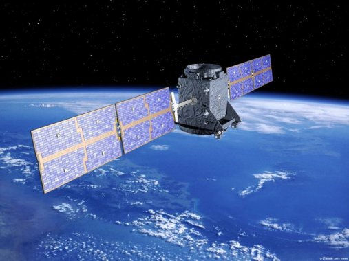
![]()
Galileo – ESA and GSA project
The project effectively began in 1999, when different concepts of the three main contributors of ESA (Germany, France and Italy) for Galileo were compared and reduced to one by a joint-team of engineers from all three countries. The first stage of the Galileo programme was agreed upon officially on 26 May 2003 by the European Union and the European Space Agency. The first experimental satellite, GIOVE-A, was launched into orbit in December 2005 and was followed by a second test satellite, GIOVE-B, which was launched in April 2008.
GIOVE-A satellite
After successful completion of the In-Orbit Validation (IOV) phase (testing procedure), additional satellites were launched. In November 2007 the 27 EU transportation ministers involved reached an agreement that Galileo should be operational by 2013, but later press releases suggest it was delayed to 2014, and finally became operational in December 2016.
SYSTEM INFO
Galileo contains two essential parts of the GNSS systems, which are divided into space segment and ground segment.
Space segment information:
- 30 in-orbit satellites (24 in full service and 6 spares)
- Orbital altitude: 23,222 km (MEO – medium earth orbit)
- 3 orbital planes, 56° inclination, ascending nodes separated by 120° longitude (8 operational satellites and 2 active spares per orbital plane)
- Satellite lifetime: >12 years
- Satellite mass: 675 kg
- Satellite body dimensions: 2.7 m × 1.2 m × 1.1 m
- Span of solar arrays: 18.7 m
- Power of solar arrays: 1.5 kW (end of life)

Constellation visibility from a location on Earth’s surface
- 1 ground control centre, located in Oberpfaffenhofen, Germany
- 1 ground mission centre, located in Fucino, Italy
- 5 tracking stations, located in Kiruna, Kourou, Noumea, Sainte-Marie, Réunion & Redu
- Several uplink stations
- Several sensor stations
- A data dissemination network between stations
SURVEYING SERVICES
The Galileo system will offer five main services:
Open access navigation
Is a free mass-market service for users with enabled chipsets in, for instance, smartphones and car navigation systems. Fully interoperable with GPS, combined coverage will deliver more accurate (approximately 1m) and reliable positioning for users.
Commercial navigation (encrypted)
Offers high precision to the centimetre; guaranteed service for which service providers will charge fees.
Safety of life navigation
Open service; for applications where guaranteed precision is essential. Integrity messages will warn of errors.
Public regulated navigation (encrypted)
Continuous availability even if other services are disabled in time of crisis. It is an encrypted, robust service for government-authorised users such as civil protection, fire brigades and the police.
Search and rescue
System will pick up distress beacon locations; feasible to send feedback, e.g. confirming help is on its way. The time between someone locating a distress beacon when lost at sea or in the wilderness will be reduced from up to three hours to just 10 minutes, with its location determined to within 5 km, rather than the previous 10 km.
For now, Galileo is providing three service types (Opean access navigation, Public regulated navigation and Search and rescue), the availability of which will continue to be improved.
Sources: http://www.esa.int/Our_Activities/Navigation/Galileo_and_EGNOS, https://en.wikipedia.org/wiki/Galileo_(satellite_navigation), https://www.sstl.co.uk/Missions/GIOVE-A-Launched-2005

You must be logged in to post a comment.